
RIEGL VQ-880-G II
Based on the proven topo-hydrographic airborne laser scanning system VQ-880-G, RIEGL now presents the new VQ-880-G II, which impresses with improved performance of the IR channel and offers ...
3DM PLUGIN FOR 3RD PARTY
QGIS, AutoCAD Map, ArcGIS for Desktop, ArcONLINE, GeoCortex, API access published 3D mapping data within 3rd party workflow measure, overlay and extract from Imagery & Point Cloud


3DM FEATURE EXTRACTION
Complete mapping unit for Image, LiDAR and DSM mapping process features and results in semi- or full automated mode document assets, centralize data management roles and permissions for ...

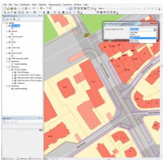
Orbit 3DM Content Manager
organize & manage, catalog & archive improve & optimize image and point cloud data QA/QC, document and report independent deliver ready-made projects after capture upload to share online

AVEVA LFM Server
Import 3D scan data and interface with all major 3D CAD packages. Different Modes. One unified work process.

Aeroscout Scout B-330 UAV Helicopter
Aeroscout provides autonomously flying, industrial unmanned helicopters for aerial imagery and photogrammetry, aerial video recording, surveillance and inspection, 3D laser mapping, search ...

Bentley Pointools
Quickly visualize, manipulate, animate, and edit point clouds all in a single workflow. This streamlined process helps you decrease production time and increase overall accuracy.


Bentley Descartes
Bentley Descartes is an information modeling software product and an extension of MicroStation, for visualization, vector-to-raster, raster-to-vector conversion, and the management and ...

Bentley MicroStation
MicroStation is the world’s leading information modeling environment explicitly for the architecture, engineering, construction, and operation of all infrastructure types including utility ...

microTABI-640
Portable air/ground broadband pushbroom thermal (MWIR) featuring a small form factor (~2 kg), wide imaging array, and high thermal resolution.

microSASI-384
Portable air/ground hyperspectral pushbroom SWIR featuring a small form factor (~2 kg).

microCASI-1920
Portable air/ground hyperspectral pushbroom VNIR featuring a small form factor (<1.5 kg), 288 programmable channels, and wide imaging array.

ContextCapture
With ContextCapture, you can produce even the largest and most challenging 3D models of existing real-world conditions, including scales as large as entire cities, from simple photographs, ...


Z+F IMAGER® 5010X
Indoor positioning system and GPS for instant automatic registration in the field

RIEGL VMQ-1HA
The RIEGL VMQ-1HA is a compact, economically priced High-Speed Single Scanner Mapping System, well suited for a variety of mobile mapping applications.

RIEGL VQ-1560i and NEW RIEGL VQ-1560i-DW
The new ultra-high performance, fully integrated and calibrated Dual Channel Airborne Mapping System RIEGL VQ-1560i makes use of RIEGL's sophisticated Waveform-LiDAR technology enabling an ...

RIEGL VQ-880-G and NEW RIEGL VQ-880-GH
The RIEGL VQ-880-G is a fully integrated airborne laser scanning system for combined hydrographic and topographic surveying.