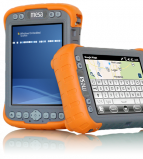
Mesa Rugged Notepad
WORLD’S FIRST RUGGED NOTEPAD Meet the Mesa Rugged Notepad™— featuring the advantages of both a tablet PC and a rugged handheld computer, without the disadvantages of either.

Archer 2
WHEREVER YOUR JOB TAKES YOU From the hammer and anvil, the Archer 2 has emerged faster, smarter, and more sophisticated than ever before, claiming top spot among the most advanced rugged ...

Allegro 2
DESIGNED FOR THE DATA-INTENSIVE From the carefully selected, textured buttons which click with just the right amount of feedback, to the slope of the contours that mimic so perfectly the ...

Mesa 2 Rugged Tablet
YOUR OFFICE, ANYWHERE Introducing… your new office. In a sleek package with the highest-rated protection against water and dust, the Mesa 2 Rugged Tablet can go with you into the ...

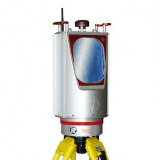
RIEGL VMZ
The new, fully integrated, accurate, and compact RIEGL VMZ Hybrid Mobile Laser Mapping System enables combined static and kinematic data acquisition using a single RIEGL VZ-400, VZ-1000 or ...

Kangur-Lift System
System for lifting of the Level-Plane Evo 14, composed of a telescopic column with pneumatic extension by hand pump.

Level-Plane Evo 14
Platform for automatic biaxial leveling with accuracy +/-3”, for 3D Laser Scanner surveys or robotic Total Station

Kangur-Lift
System for the lifting of 3D Laser Scanner, composed of a telescopic column with pneumatic extension by hand pump.

LFM NetView
LFM NetView provides secure access to remote 3D laser scan data. More than an online viewing package, it provides tools that allow users to work collaboratively with laser scan data over ...

LFM Modeller
Produce 3D CAD models from as-built laser scan data. Model pipes and structural standards from the standards library using BubbleView™ Modelling. Export intelligent 3D models into a range ...
RIEGL VZ-4000
Offers superior and unrivaled long range measurement performance of up to 4000 m reflectorlessly (Laser Class 1).
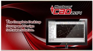
MicroSurvey CAD2014
MicroSurvey CAD is a Complete Desktop Survey and Design Program Created for Surveyors, Contractors and Engineers

MicroSurvey STAR*NET V8
32-bit Windows package that adjusts 2D/3D survey networks using rigorous Least Squares techniques.