

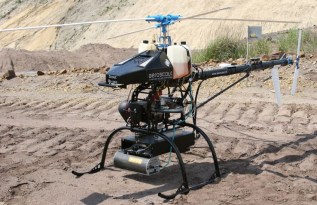
Aeroscout Scout B-330 UAV Helicopter
Aeroscout provides autonomously flying, industrial unmanned helicopters for aerial imagery and photogrammetry, aerial video recording, surveillance and inspection, 3D laser mapping, search ...

RIEGL VMZ
The new, fully integrated, accurate, and compact RIEGL VMZ Hybrid Mobile Laser Mapping System enables combined static and kinematic data acquisition using a single RIEGL VZ-400, VZ-1000 or ...
Aeroscout Scout B1-100
Aeroscout provides autonomously flying, industrial unmanned helicopters for aerial imagery and photogrammetry, aerial video recording, surveillance and inspection, 3D laser mapping, search ...

Z+F SynCat®
SynCaT stands for synchronization, calibration and transformation - also representing the main tasks of the software

Z+F LaserControl® Office and Scout
Optimal solution to work efficiently and fully with the laser scanners of Zoller + Fröhlich

UNDET
Developed by 3D measurement professionals with an excellent understanding of the needs and challenges that come with 3D measurement and as-built documentation preparation based on point ...
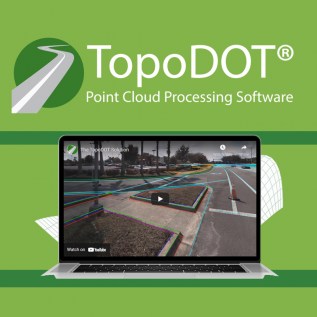
TopoDOT
TopoDOT is CAD application for extracting high quality models from LiDAR system data

TerraSolid TerraStereo
TerraStereo is a stand-along application for visualizing very large point clouds

TerraSolid TerraPhoto
TerraPhoto is specifically developed for processing images captured together with laser data during a survey mission

TerraSolid TerraMatch
TerraMatch allows for strip adjustment of laser data from many different moving sensors, both airborne and mobile.

TerraSolid TerraModeler
TerraModeler offers versatile visualization options including colored shaded surfaces, contour line, grids, colored triangle nets, elevation texts, slope directions and textured surfaces

TerraSolid TerraScan
TerraScan is the main application in the Terrasolid Software family for managing and processing all types of point cloud

RIEGL RiSOLVE 2.0
Combined with the one-touch workflow of the RIEGL V-Line Terrestrial Laser Scanners, RiSOLVE enables fully automatic registration and colorization of scan data


RIEGL RiSCAN PRO 2.0
The 64-bit architecture, geo-referencing support of GeoSysManager 2.0, as well as support for Ultra High Definition (UHD) displays offer new possibilities and speed up processing

RIEGL LIS ALS Classification Plugin
This plugin provides methods to classify airborne LiDAR collections to ground, building, and low/medium/high vegetation

RIEGL RiHYDRO
For smooth processing of scan data acquired with RIEGL Hydrography Laser Scanners the Airborne Data Processing Software AddOn RiHYDRO is offered as supplement to RiPROCESS

RIEGL RiPRECISION UAV
RiPRECISION UAV automatically performs adjustments of GNSS/INS trajectories to merge overlapping UAV-based RIEGL scan data

RIEGL RiPRECISION MLS
RiPRECISION MLS automatically performs ad-justments of GNSS/INS trajectories to merge overlapping mobile scan data